By Our Correspondent
BHUBANESWAR: Amidst the Covid-19 pandemic, the SOA Deemed to be University here organised a five-day AICTE Training and Learning (ATAL) Faculty Development Program which concluded here.
The program on state-of-the-art technology on the subject ‘Geographical Information System, Remote Sensing and Applications’ was held online at the Institute of Technical Education and Research (ITER), SOA’s faculty of engineering and technology, Prof. Manas Ranjan Das, Head of the department of Civil Engineering and Coordinator of the program, said.
ATAL was launched to plan and help in imparting quality technical education in the country and support technical institutions in fostering research, innovation and entrepreneurship through training in various emerging areas.
The program contained nine lecture sessions and five hands-on sessions designed to create awareness among the participants and make them conversant with the GIS and Remote Sensing technology now being used in every sphere of planning and management, Prof. Das said.
The resource persons included eminent Climatologist Prof. U.C.Mohanty from IIT, Bhubaneswar, reputed Remote Sensing expert Prof. G. K. Panda from Utkal University, GIS and Health Care Planning expert Dr. Mithun Karmakar from NHM-Odisha and World Bank consultant Dr. Nihar Das besides Dr. Debadatta Swain from IIT, Bhubaneswar, Dr. R.K.Barik, GIS Expert and Ms. Lusi Nayak and Ms. Subasini Pradhan, GIS Executives from Foundation for Environmental and Social Research
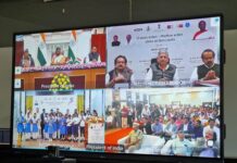
Around 150 participants from all over the country participated in the FDP which was virtually inaugurated along with 42 other FDPs elsewhere by the AICTE Chairman Prof. Anil Sahasrabudhe. SOA Registrar Prof. B. B. Pradhan was among the panelists while the valedictory address was delivered by Prof. P. K. Sahoo, Dean, ITER.


