By Our Correspondent
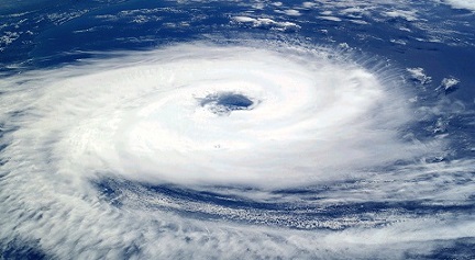
BHUBANESWAR: The well marked low pressure area (LOPAR), which lay over south-east Bay of Bengal yesterday, concentrated into a depression early this morning and was centered about 1060 km south of Paradip at 8.30 am, the Centre for Environment and Climate (CEC), SOA Deemed to be University here, said.
The system was likely to intensify rapidly into a cyclonic storm tonight and move in a north-westerly direction till May 17. It was then expected to recurve north-northeastwards thereafter till landfall occured on May 20 afternoon, Dr. Sarat Chandra Sahu, Director, CEC, said.Dr. Sahu said the system was expected to move parallel to the eastern coast up to south Odisha till May 19 but it could also move close to Odisha coast encompassing the districts between Puri and Balasore the same night. Some other models indicated that the system might cross the coast somewhere in north Odisha or West Bengal.
However, the actual path of the system, which was intensifying gradually, could be ascertained tomorrow, he said.In case it moved very close to Odisha coast, the wind speed may reach 140 km per hour on the night of May 19 and also during the day on May 20. But if it crossed the Odisha coast, the wind speed may go up to 160-180 km per hour, Dr. Sahu said adding the system would gradually intensify to an extreme severe cyclonic storm between May 17 and 19.
Under its influence, along with monsoon current in the Bay of Bengal, the districts of Malkangiri, Koraput, Rayagada, Ganjam, Puri and Jagatsinghpur might experience moderate to heavy rainfall on May 18 but heavy to very heavy precipitation could occur at many places with extremely heavy rainfall at a few locations in the districts of Puri, Jagatsinghpur, Kendrapara, Bhadrak, Balasore, Jajpur and Mayurbhanj on May 19 and 20.Moderate to heavy rainfall could occur in the districts of Nayagarh, Khurda, Cuttack, Dhenkanal, Keonjhar and Angul during the same period, he said.


