By Our Correspondent/PIB
NEW DELHI/BHUBANESWAR: As per the records maintained by Defence Estates Offices, the Ministry of Defence owns large tracts of land admeasuring about 17.99 lakh acres out of which approximately 1.61 lakh acres is situated within the 62 notified Cantonments. About 16.38 lakh acres is spread across many pockets outside the Cantonments. Out of 16.38 lakh acres land, about 18,000 acres is either state hired land or is proposed for deletion from records on account of transfer to other Govt. Depts.
Clear demarcation and boundary survey of defence lands and fixing of the boundaries is necessary for protection of the defence land, safeguarding of the title of MOD, updation of land records, maps and prevention of encroachments. Towards this end, the Directorate General Defence Estates, Ministry of Defence commenced the Survey of defence land from October 2018.
The entire exercise of survey of about 1.61 lakh acres of defence land inside cantonments and 16.17 lakh acres outside cantonments (total 17.78 lakh acres) survey has been completed. It is a remarkable achievement since for the first time after independence, entire defence land has been surveyed by using latest survey technology and in a large number of pockets in association with the Revenue authorities of various State Governments. The magnitude of land holding, location of land in approximately 4,900 pockets across the country, inaccessible terrain in many places and association of various stakeholders makes this survey one of the largest land surveys in the country.
Modern survey technologies like Electronic Total Station (ETS) and Differential Global Positioning System (DGPS) were used in the survey. To further speed up the process, Drone imagery and Satellite imagery based survey were leveraged for reliable, robust and time bound outcomes.
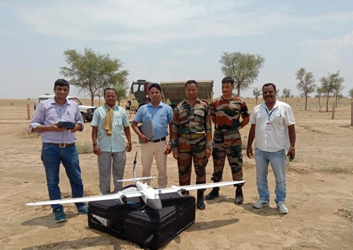
For the first time, Drone imagery based survey technology was used for survey of lakhs of acres of defence land in Rajasthan. The entire area was surveyed with the help of Surveyor General of India in a matter of weeks, which earlier used to take years.
Besides this, Satellite Imagery based survey was done for the first time for many defence land pockets, especially for certain pockets again measuring lakhs acres of defence land.
3D Modelling techniques for better visualisation of defence land in hilly area have also been introduced by utilising Digital Elevation Model (DEM) in association with Bhabha Atomic Research Centre (BARC).
During the last 6 months, as a result of the active intervention of Defence Secretary and use of latest survey technologies, the survey progressed at a much faster pace, which is evident from the fact that out of 17.78 lakh acres, 8.90 lakh acres was surveyed during the last three months.
As a part of Survey, a project for real time change detection system based on the Time series Satellite imagery for detection of encroachments on defence land has also been initiated. Pilot test has been carried out on satellite imageries of defence land pockets procured from National Remote Sensing Centre, Hyderabad.
Geo-referenced and digitised shape files are made available to enable quick decision making by officials of DGDE & MoD.
Association of Revenue officials in survey will eventually help in reducing boundary disputes amongst stakeholders and would also help in resolving legal disputes at various levels.
Completion of such a humongous survey has been made possible due to Capacity Building of technical personnel and officers of Defence Estates Organisation in latest technologies for Land survey over the years in association with premier institutes like National Remote Sensing Centre and National Institute for Geo-Informatics Science and Technology.
A Centre of Excellence (CoE) on Land Survey and GIS mapping has also been established in NIDEM (National Institute of Defence Estates Management) for capacity building of Defence Estates officials in the field of latest survey technologies. The CoE aims to be an apex survey institution capable to impart training of various levels to the officers of Central & State Govt. Depts. CoE also aims to use SLAM/GIS technologies in better land management & town planning process. Hon’ble Raksha Mantri while inaugurating the Centre of Excellence during last month exhorted DGDE organization to continue to excel in the field survey and building capacity in using GIS based technologies
This mammoth exercise of survey of nearly 18 lakh acres of defence land spread pan India, which hitherto rested on the fulcrum of herculean human efforts, is a unique example of leveraging emerging technologies for land survey in a short time in line with the Central Govt’s emphasis on Digital India. The fact that such an exercise has been conducted after 75 years of Independence, also makes it a part of celebrations under the AZADI KA AMRUT MAHOTSAV.


